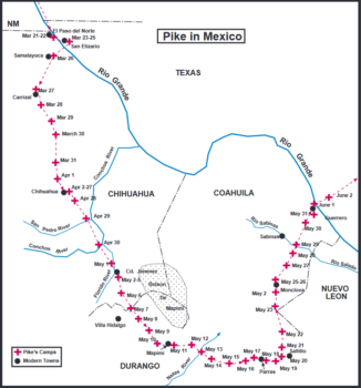
 This section will describe Pike’s journey from El Paso del Norte (Cd. Juarez, Mexico) to the present international boundary at the Rio Grande between Coahuila, Mexico, and Texas. A word here on the political geography of Pike’s journey from St. Louis to Louisiana. The Spanish did not accept the U S claims made for the Louisiana Purchase. While the U S claimed territory to the headwaters of the Arkansas and Red rivers (finding these sources was a major part of Pike’s reasons for coming), the Spanish position was that Pike was trespassing almost from the instant he left St. Louis. The vast area traversed by Zebulon Pike was “disputed territory.”
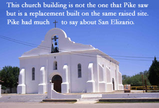
Now, when we begin with Pike at El Paso del Norte in the province of Nueva Vizcaya this was not a political boundary. Pike had entered Nueva Vizcaya when he crossed the Sangre de Cristo north of Santa Fe. There was no Mexico until 1821 so our divisions are arbitrary. Pike left El Paso del Norte on March 23, 1807 and stayed at the presidial town of San Elizario until the 25th.
Pike and Melgares (Melgares was commander of the escort) traveled on the two hundred-year-old Camino Real (Juan de Oñate had opened the Camino in 1598) toward Chihuahua. Their first stop was at the spring at Samalayuca (Pike’s “Ogo mall Ukap”) and then the presidio at Carrizal.
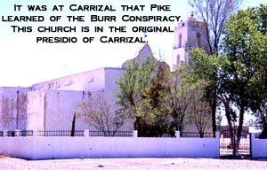
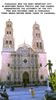
It was at Carrizal that Pike learned of Burr’s conspiracies in the U S. From Carrizal, Pike continued south on the Camino Real arriving at Chihuahua on the 2nd of April where he remained until the 28th.
Commandant General Salcedo interrogated Pike at great length during his stay in Chihuahua. From this point on Pike was fully aware of the military importance given to his trip by the Spaniards. Salcedo needed to know if Pike was sent to reconnoiter for an American invasion.
Pike and Melgares left Chihuahua on the 28th of April staying at several villages along the Camino Real before reaching the presidio town of Guajoquilla on May 2nd. Melgares passed his responsibility for Pike to another officer, Varela, at Guajoquilla (present name is Cd. Jimenez).
From Guajoquilla, Pike and escort went south along the established route through another old presidio town Mapimí. Looking at a map of Pike’s route one notes the wide detour around the Bolsón de Mapimí an extremely arid region in southeast Chihuahua state and western Coahuila state. Even today there are few settlements in this environmentally hostile area.
Pike’s journal, now considerably abbreviated because of restrictions placed on his note taking by General Salcedo, is difficult to follow in this region. We find him at Parras on the 17th of May and Monclova on the 25th. They arrived at the presidio Rio Grande (today Guerrero, Coahuila) on June 1, 1807. At the Rio Grande he crossed the river, still in Coahuila, and heads toward San Antonio. The boundary between Coahuila and Tejas was just west of San Antonio.
![Introducing the General Zebulon Montgomery Pike INTERNational Historic Trail [ZPIT]](https://www.zebulonpike.org/wp-content/uploads/2018/07/21-St-Anthony-Falls-144dpi-wm-150x150.jpg)

